

MapOut
Valnova GmbH
- 开发者
- Valnova GmbH
- 版本
- 3.4.14
- 最低 iOS 版本
- 13
- 年龄分级
- 4+
- App Store 评分
- 4.88 / 5 (142)
- 应用支持语言
- EN, FR, DE
App Store 地区: 美国 · 核验于: 2026年9月20日
来源与方法 ↗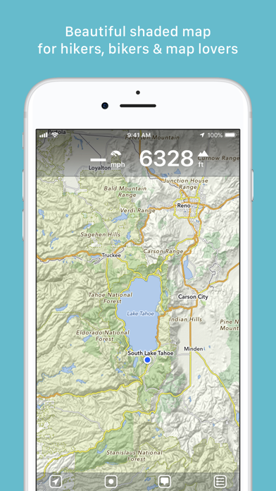
应用介绍
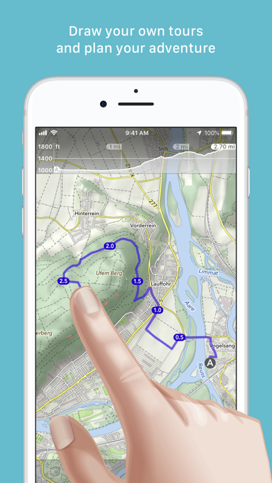
“MapOut saves the day with its intuitive interface for drawing routes and viewing elevation profiles. I’m genuinely impressed by its powerful features!” – Alee, cyclingabout.com Offline maps covering the entire globe, optimized for iPhone and iPad. As beautiful as a traditional paper map—but far more versatile. Perfectly tailored for: - Hikers: Clear, detailed terrain maps accessible even in the most remote locations, without an internet connection. - Cyclists: Extensive cycling route network with real-time speed and distance tracking. - City Travelers: Detailed city maps complete with essential tourist information. - Map Enthusiasts: Simply elegant maps that are a pleasure to view. Innovative 3D Tilt View - Tilt your device in any direction to vividly explore terrain details. Learn more at [mapout.app](https://mapout.app). Powerful Offline Search - Easily find places, streets, mountains, and more—no internet needed. High-Quality Map Data - Built upon the OpenStreetMap project, the "Wikipedia of Maps". Contribute your own corrections and additions at OpenStreetMap.org. - Regularly updated offline maps available for your selected regions. Effortless Tour Planning - Draw: Easily create custom routes and waypoints directly on your map. Adjust existing tours or imported GPX files effortlessly. - Import: Transfer routes to your device via email using a free "MapOut.me" account. Discover countless GPX and KML route files online, ideal for hiking or biking (e.g., gpsies.com). - Record: Capture your adventures and easily share them with friends. - Insights: Quickly see vital information for every tour—distance, elevation changes, route profile, and map details. Superior Map Viewing Experience - Rapid, hardware-accelerated rendering for smooth navigation. - Continuous zoom with impeccable clarity at every level. - Detailed topographical views featuring contour lines and shading. - Versatile overlays include biking, hiking, skiing routes, sightseeing locations, and public transport networks. Find comprehensive support and answers in our user manual: https://mapout.app/manual Map data © OpenStreetMap contributors https://www.openstreetmap.org/copyright
更新内容
- Fixes an issue on iPad that prevented hand-drawn tours from being saved - Various bug fixes and optimizations